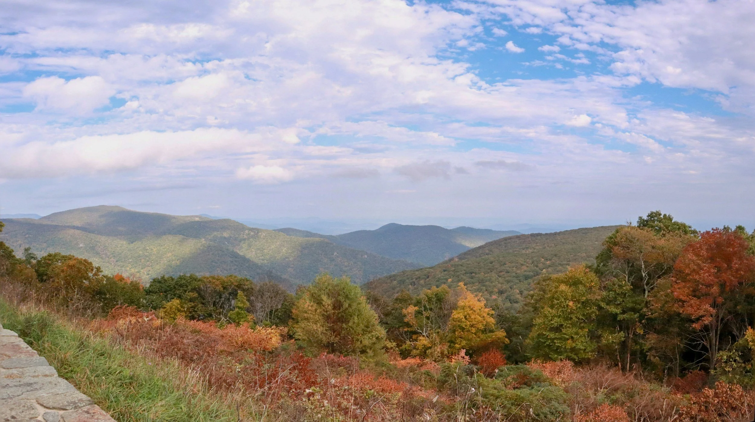
Skyline Drive
Skyline Drive Trailheads (North to South)
Mile 4.6 — Dickey Ridge Visitor Center Trailhead (West Side)
Main Hikes: Fox Hollow Trail (1.2-mile loop), Dickey Ridge Trail (5.0 miles out-and-back)
Difficulty: Easy (Fox Hollow) / Moderate (Dickey Ridge)
Webmaster Note: Excellent family hub with indoor restrooms and exhibits. Pets are prohibited on the Fox Hollow loop. Intersects a historical cemetery.
Mile 5.1 — Snead Farm Trailhead (West Side)
Main Hikes: Snead Farm Loop (3.1 miles)
Difficulty: Easy to Moderate
Webmaster Note: Fully dog-friendly. Leads to an abandoned historic orchard, a preserved wooden barn, and a stone fire tower clearing.
Mile 9.2 — Lands Run Gap Trailhead (East Side)
Main Hikes: Lands Run Falls (1.3 miles out-and-back)
Difficulty: Moderate
Webmaster Note: Dog-friendly. Follows a wide, unpaved fire road descending into a rocky gorge featuring a series of small, step-like cascades.
Mile 10.4 — Compton Gap Trailhead (East Side)
Main Hikes: Compton Peak East & West (2.4 miles out-and-back)
Difficulty: Moderate
Webmaster Note: Dog-friendly. Directly cross-sections the Appalachian Trail. The eastern branch terminates at a unique, geometric basalt greenstone cliffside formation.
Mile 12.4 — Jenkins Gap Trailhead (East Side)
Main Hikes: Mount Marshall Trail loop options (Varies, 3.5 to 7.0 miles)
Difficulty: Moderate
Webmaster Note: Dog-friendly. Primarily acts as a junction point for the Appalachian Trail and Jenkins Gap fire roads. Lower traffic area ideal for quiet woods hiking.
Mile 17.6 — Gravel Springs Gap Trailhead (East Side)
Main Hikes: Mount Marshall / South Marshall Summit (2.5 miles)
Difficulty: Moderate
Webmaster Note: Dog-friendly. Provides direct access to a standard trail shelter. Offers a steady, wooded uphill climb to scenic gaps on the Mount Marshall loop.
Mile 21.1 — Hogback Mountain Trailhead (West Side)
Main Hikes: Hogback Summit Spur (0.5 miles), Piney River Circuit (6.0 miles)
Difficulty: Easy (Spur) / Strenuous (Circuit)
Webmaster Note: Dog-friendly. Hits the highest peak in the North District (3,385 ft). Features communication towers at the top and expansive valley views.
Mile 22.2 — Mathews Arm Campground Trailhead (West Side)
Main Hikes: Overall Run Falls (6.5 miles out-and-back), Traces Trail (1.7-mile loop)
Difficulty: Strenuous (Falls) / Easy (Traces)
Webmaster Note: Dog-friendly. Access point to the tallest waterfall in the park (90 feet). Note that stream flows can completely dry up by late summer.
Mile 24.1 — Elkwallow Picnic Area Trailhead (East Side)
Main Hikes: Jeremys Run Loop (10.0+ mile wilderness circuit)
Difficulty: Strenuous
Webmaster Note: Dog-friendly. This serves as the upper ridge launching pad for an expansive backcountry stream loop requiring multiple water crossings.
Mile 28.5 — Beahms Gap Trailhead (East Side)
Main Hikes: Pass Mountain Summit via AT (3.2 miles out-and-back)
Difficulty: Moderate
Webmaster Note: Dog-friendly. Simple unpaved parking pullover intersecting historic stone walls and wagon road paths.
Mile 31.6 — Thornton Gap / Panorama Trailhead (East Side)
Main Hikes: Marys Rock Summit (3.7 miles out-and-back)
Difficulty: Moderate to Strenuous
Webmaster Note: Dog-friendly. Extremely popular and heavily trafficked hub located at the Route 211 intersection. Steep elevation gain leading to a rocky 360-degree vista.
Mile 37.9 — Coronado / Meadow Spring Trailhead (East Side)
Main Hikes: Meadow Spring to Marys Rock (2.8 miles out-and-back)
Difficulty: Moderate
Webmaster Note: Dog-friendly. A shorter, alternate southern approach to Marys Rock that passes an old chimney ruin and historic orchards.
Mile 41.7 — Stony Man Trailhead (West Side)
Main Hikes: Stony Man Summit (1.6-mile loop), Little Stony Man (0.9 miles)
Difficulty: Easy
Webmaster Note: Pets are strictly prohibited on the final summit spur trail. Delivers an exceptional effort-to-reward ratio for western valley sunset viewing.
Mile 42.6 — Whiteoak Canyon Upper Trailhead (East Side)
Main Hikes: Upper Whiteoak Falls (4.6 miles out-and-back)
Difficulty: Strenuous
Webmaster Note: Dog-friendly. High-congestion parking hub. Features steep canyon paths tracing cascading mountain rivers down to deep swimming pools.
Mile 43.0 — Limberlost Trailhead (East Side)
Main Hikes: Limberlost Trail (1.3-mile flat circuit)
Difficulty: Very Easy (ADA Accessible)
Webmaster Note: Fully ADA accessible, crushed greenstone path with comprehensive boardwalk components and benches. Pets are prohibited.
Mile 45.6 — Skyland / Millers Head Trailhead (West Side)
Main Hikes: Millers Head Lookout (1.6 miles out-and-back)
Difficulty: Moderate
Webmaster Note: Dog-friendly. Located within the Skyland resort complex. Descends out to an active historic fire lookout platform perched on a rocky spur.
Mile 46.7 — Hawksbill Gap Trailhead (West Side)
Main Hikes: Hawksbill Summit Loop (2.1 miles)
Difficulty: Moderate but continuously steep
Webmaster Note: Dog-friendly. Leads to the absolute highest point in Shenandoah National Park (4,050 feet), complete with an open-air stone observation deck.
Mile 49.4 — Rose River / Fishers Gap Trailhead (East Side)
Main Hikes: Rose River Falls Loop (4.0 miles), Dark Hollow Falls descent
Difficulty: Moderate
Webmaster Note: Dog-friendly on the Rose River loop. Tracks an ancient copper-mining hollow and stays close to running water for the majority of the hike.
Mile 50.7 — Dark Hollow Falls Trailhead (East Side)
Main Hikes: Dark Hollow Falls (1.4 miles out-and-back)
Difficulty: Moderate but extremely steep return
Webmaster Note: Pets are strictly prohibited. The single most heavily crowded waterfall parking lot in the park. The return trail requires climbing straight back up the mountain.
Mile 52.8 — Milam Gap Trailhead (West Side)
Main Hikes: Mill Prong Trail to Rapidan Camp (4.0 miles out-and-back)
Difficulty: Moderate
Webmaster Note: Dog-friendly. Historic path leading down to the presidential fishing retreat established by Herbert Hoover.
Mile 56.4 — Bearfence Mountain Trailhead (East Side)
Main Hikes: Bearfence Rock Scramble (1.2-mile loop)
Difficulty: Strenuous
Webmaster Note: Pets are strictly prohibited. A true, technical hands-on rock scramble along an exposed jagged knife-edge ridge with 360-degree views. Avoid during rain or icy weather.
Mile 57.5 — Lewis Mountain Trailhead (West Side)
Main Hikes: Lewis Spring Falls (3.3-mile loop)
Difficulty: Moderate to Strenuous
Webmaster Note: Dog-friendly. Quiet campground launching pad leading down to an overlooked 81-foot waterfall structure.
Mile 65.5 — South River Picnic Area Trailhead (East Side)
Main Hikes: South River Falls (3.3 miles out-and-back)
Difficulty: Moderate
Webmaster Note: Dog-friendly. Features a stone observation ledge looking over a deep canyon waterfall. Excellent picnic facilities on site.
Mile 66.7 — Hightop Mountain Trailhead (East Side)
Main Hikes: Hightop Summit (3.0 miles out-and-back)
Difficulty: Moderate
Webmaster Note: Dog-friendly. Climbs to the loftiest peak in the South District. Less crowded, deeply shaded, and heavy with spring wildflowers.
Mile 79.5 — Loft Mountain / Frazier Trailhead (East Side)
Main Hikes: Frazier Discovery Trail (1.2-mile loop)
Difficulty: Moderate
Webmaster Note: Dog-friendly. Great introductory nature trail looping through regenerating mountain meadows and blocky greenstone outcrops.
Mile 81.1 — Doyles River Trailhead (East Side)
Main Hikes: Doyles River Upper & Lower Falls (2.7 miles), Jones Run Loop (6.5 miles)
Difficulty: Strenuous
Webmaster Note: Dog-friendly. A deep, wilderness stream hollow that can be paired with Jones Run to create a double-waterfall circuit hike.
Mile 84.8 — Blackrock Summit Trailhead (West Side)
Main Hikes: Blackrock Summit Loop (1.0-mile loop)
Difficulty: Easy
Webmaster Note: Dog-friendly. High reward with minimal exertion. Circuits a massive, loose quartz talus boulder field with stunning mountain views.
Mile 90.0 — Riprap Trailhead (West Side)
Main Hikes: Riprap Circuit / Chimney Rock (3.4 to 9.8 miles)
Difficulty: Strenuous
Webmaster Note: Dog-friendly. Renowned for its unique freestanding pillar rock formations, wide valley views, and deep stream-fed swimming holes.
Mile 99.5 — Beagle Gap Trailhead (East Side)
Main Hikes: Calf Mountain Summit via AT (2.2 miles out-and-back)
Difficulty: Easy to Moderate
Webmaster Note: Dog-friendly. Crosses wide, open meadow landscapes and rolling pastures along the southernmost stretch of the park ridge.
Perimeter Boundary Trailheads (North to South)
Thompson Hollow Trailhead (West Boundary — Bentonville/Browntown side)
Main Hikes: Lower Overall Run Falls & Pool access (5.0 miles out-and-back)
Difficulty: Moderate
Webmaster Note: Dog-friendly. Highly valued local shortcut to the deep swimming pools below Overall Run. Parking is restricted to a narrow gravel shoulder; stay clear of private driveways.
Keyser Run / Little Devils Stairs Trailhead (East Boundary — Flint Hill side)
Main Hikes: Little Devils Stairs Canyon Loop (5.3 to 7.4 miles)
Difficulty: Strenuous
Webmaster Note: Pets are strictly prohibited. Situated at the end of Route 614. Inverts the hike format—climbers complete the vertical rocky canyon gorge scramble first, then coast down the smooth fire road.
Nethers / Old Rag Trailhead (East Boundary — Sperryville/Etlan side)
Main Hikes: Old Rag Mountain Ridge Reef Loop (9.4 miles)
Difficulty: Extreme
Webmaster Note: Pets are strictly prohibited. Critical Site Notice: Requires a dedicated day-use reservation ticket purchased online in advance from March through November. Features a large, developed country parking lot with permanent park structures.
Whiteoak Canyon Lower Trailhead (East Boundary — Syria/Madison side)
Main Hikes: Cedar Run & Whiteoak Canyon Full Loop (7.3 to 8.2 miles)
Difficulty: Strenuous
Webmaster Note: Dog-friendly. Located at the terminus of Route 600. Approaching from the bottom means hiking up next to the waterfalls, saving your knees on the return trip. Large gravel lot with a self-pay vault box.
Graves Mill Trailhead (East Boundary — Syria side)
Main Hikes: Staunton River / Rapidan River wilderness loops (5.5 miles)
Difficulty: Easy to Moderate
Webmaster Note: Dog-friendly. Branching off Route 615, this lot offers a flat entry along trout rivers. Popular entry for backcountry fly-fishing and wilderness campers.
Pocosin Hollow Trailhead (East Boundary — Stanardsville side)
Main Hikes: Pocosin Fire Road to Mission Ruins (6.0 miles out-and-back)
Difficulty: Moderate
Webmaster Note: Dog-friendly. Accessed via Route 624. A remote boundary gate that walks through historical stone foundations and old Episcopal mission ruins.
Swift Run Valley Trailhead (West Boundary — Elkton side)
Main Hikes: Swift Run / Naked Creek lower gaps (Varies)
Difficulty: Moderate to Strenuous
Webmaster Note: Dog-friendly. Tucked away on Route 609 near Elkton. Offers minimal parking space on a rough mountain dirt shoulder. Primarily used by backcountry campers seeking remote streams.
Madison Run Trailhead (West Boundary — Grottoes side)
Main Hikes: Madison Run Fire Road to Furnace Mountain / Blackrock (Varies)
Difficulty: Moderate to Strenuous
Webmaster Note: Dog-friendly. Located off Route 663. A wide, gated access road that ascends the rugged lower slopes of the South District, reaching the quartz rock fields from below.
Overlooks in Shenandoah National Park. West side overlooks are perfect for viewing sunsets. East side overlooks can provide amazing sunrise views.
North District (Mile 0 to 31.5)
Mile 2.8 — Shenandoah Valley Overlook (West Side | 1,390 ft)
Mile 5.5 — Signal Knob Overlook (West Side | 2,085 ft)
Mile 6.8 — Gooney Run Overlook (West Side | 2,085 ft)
Mile 7.2 — Gooney Manor Overlook (West Side | 1,920 ft)
Mile 10.5 — Indian Run Overlook (East Side | 2,400 ft)
Mile 12.0 — Jenkins Gap Overlook (East Side | 2,355 ft)
Mile 13.6 — Hogwallow Flats Overlook (East Side | 2,665 ft)
Mile 15.0 — Browntown Valley Overlook (West Side | 2,890 ft)
Mile 17.0 — Range View Overlook (East Side | 2,810 ft)
Mile 18.5 — Gimlet Ridge Overlook (West Side | 2,675 ft)
Mile 19.0 — Mount Marshall Overlook (East Side | 2,850 ft)
Mile 19.4 — Little Hogback Overlook (West Side | 3,035 ft)
Mile 20.0 — Little Devils Stairs Overlook (East Side | 3,120 ft)
Mile 20.7 — Hogback Overlook (West Side | 3,385 ft)
Mile 21.0 — Rattlesnake Point Overlook (East Side | 3,105 ft)
Mile 26.5 — Jeremys Run Overlook (West Side | 2,410 ft)
Mile 27.5 — Thornton Hollow Overlook (East Side | 2,460 ft)
Mile 28.5 — Beahms Gap Overlook (West Side | 2,485 ft)
Mile 30.0 — Pass Mountain Overlook (West Side | 2,460 ft) [1, 2]
Central District (Mile 31.5 to 65.7)
Mile 33.0 — Hazel Mountain Overlook (East Side | 2,770 ft)
Mile 35.0 — Pinnacles Overlook (West Side | 3,320 ft)
Mile 36.4 — Jewell Hollow Overlook (West Side | 3,320 ft)
Mile 38.6 — Stony Man Mountain Overlook (West Side | 3,100 ft)
Mile 39.1 — Thorofare Mountain Overlook (East Side | 3,150 ft)
Mile 41.6 — Tunnel Parking Overlook (East Side | 3,250 ft)
Mile 43.0 — Timber Hollow Overlook (West Side | 3,360 ft)
Mile 44.4 — Crescent Rock Overlook (West Side | 3,550 ft)
Mile 44.9 — Franklin Cliffs Overlook (West Side | 3,140 ft)
Mile 46.5 — Old Rag View Overlook (East Side | 3,585 ft)
Mile 48.1 — Spitler Knoll Overlook (West Side | 3,285 ft)
Mile 49.3 — Dark Hollow Overlook (East Side | 3,175 ft)
Mile 50.4 — Fishers Gap Overlook (East Side | 3,060 ft)
Mile 51.2 — Tanners Ridge Overlook (West Side | 3,465 ft)
Mile 52.9 — Naked Creek Overlook (West Side | 3,220 ft)
Mile 54.5 — Hazeltop Ridge Overlook (West Side | 3,265 ft)
Mile 55.3 — The Point Overlook (West Side | 3,235 ft)
Mile 58.8 — The Oaks Overlook (East Side | 3,125 ft)
Mile 60.9 — Baldface Mountain Overlook (West Side | 3,325 ft)
Mile 62.4 — South River Overlook (East Side | 2,950 ft)
Mile 64.1 — Hensley Hollow Overlook (East Side | 2,560 ft) [1, 2]
South District (Mile 65.7 to 105.4)
Mile 67.0 — Swift Run Overlook (West Side | 2,710 ft)
Mile 67.5 — Sandy Bottom Overlook (West Side | 2,700 ft)
Mile 69.0 — Bacon Hollow Overlook (East Side | 2,450 ft)
Mile 70.5 — Eaton Hollow Overlook (West Side | 2,500 ft)
Mile 71.1 — Rocky Mount Overlook (West Side | 2,450 ft)
Mile 72.0 — Beldor Hollow Overlook (East Side | 2,345 ft)
Mile 74.5 — Loft Mountain Overlook (East Side | 2,450 ft)
Mile 76.0 — Two Mile Run Overlook (West Side | 2,770 ft)
Mile 77.0 — Brown Mountain Overlook (West Side | 2,840 ft)
Mile 77.7 — Ivy Creek Overlook (East Side | 2,885 ft)
Mile 78.2 — Rockytop Overlook (West Side | 2,860 ft)
Mile 80.8 — Big Run Overlook (West Side | 2,860 ft)
Mile 81.9 — Dundo Overlook (West Side | 2,765 ft)
Mile 83.3 — Jones Run Overlook (East Side | 2,745 ft)
Mile 84.1 — Rocks Mountain Overlook (West Side | 2,520 ft)
Mile 84.8 — Blackrock Overlook (West Side | 2,610 ft)
Mile 86.8 — Moormans River Overlook (East Side | 2,975 ft)
Mile 87.4 — Wildcat Ridge Overlook (East Side | 2,940 ft)
Mile 89.0 — Crimson Hollow Overlook (East Side | 2,700 ft)
Mile 90.0 — Riprap Overlook (West Side | 2,920 ft)
Mile 91.4 — Calf Mountain Overlook (West Side | 2,480 ft)
Mile 92.1 — Mountain Top Overlook (West Side | 2,560 ft)
Mile 92.6 — Sawmill Run Overlook (West Side | 2,210 ft)
Mile 93.5 — Turk Mountain Overlook (West Side | 2,630 ft)
Mile 95.3 — Sawmill Ridge Overlook (East Side | 2,340 ft)
Mile 95.9 — Jarman Gap Overlook (East Side | 2,165 ft)
Mile 96.9 — Beagle Gap Overlook (West Side | 2,495 ft)
Mile 100.2 — McCormick Gap Overlook (East Side | 2,410 ft)
Mile 102.4 — Love Mountain Overlook (West Side | 2,230 ft)
Mile 105.0 — Rockfish Gap Overlook (West Side | 2,070 ft
text
Data Sources & Map References:
1. National Park Service (NPS) - Shenandoah National Park Official Trail & Milepost Index
2. Appalachian Trail Conservancy (ATC) - Section Mapping (Front Royal to Rockfish Gap)
3. United States Geological Survey (USGS) - National Map Elevation & Coordinate Data
4. Skyline Drive Overlooks & Milepost Guide (skylinedriveoverlooks.com)
5. Virginia Trail Guide Repository (virginiatrailguide.com)